
Turning complex
environments into
clear insights
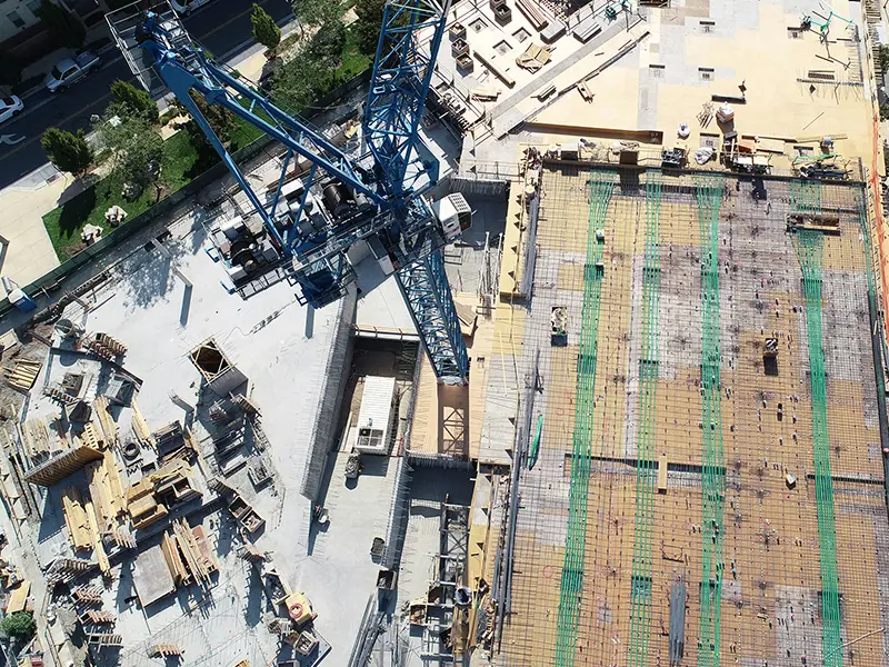
for Pipelines, Utilities & Infrastructure
An end-to-end monitoring platform covering data acquisition, regulatory compliance, and sustainability metrics – designed for real-world infrastructure operations.
Trusted by clients

Experience our Data Quality


35,539 km
critical infrastructure inspection kilometres in 2025
25
Long range drones in operation
4mm/px
GSD max. resolution
Solutions
Technologies + Platform
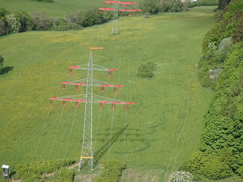
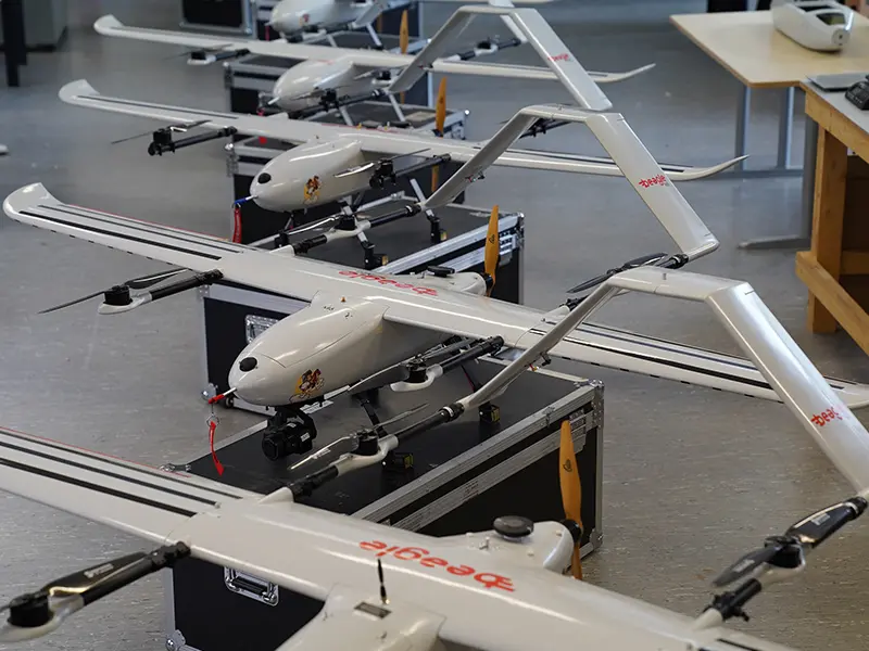
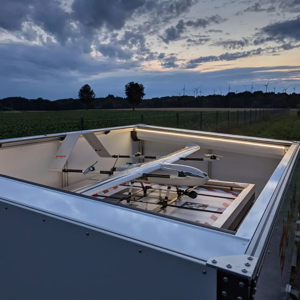
Our Beagle M Drone
BVLOS
- Flying beyond visual line of sight & without a pilot on site (BVLOS)
Range
- Up to 200 km range at an average speed of 120 km/h
Frequency
- Up to 1,000 km of inspection per day per drone
Flight altitude
- At an altitude of 90–120 m
Ground Sampling Distance (GSD)
- Up to 4mm GSD (Standard: 5cm)
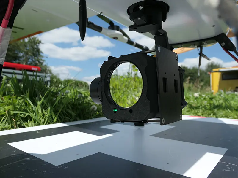
Sensors
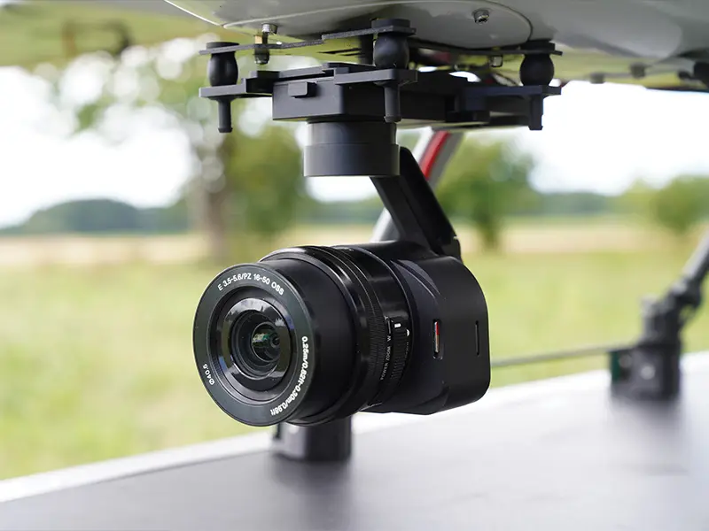
Sony ILX Series
- 61MP
- Emount lenses
- Gimbal stabilization
Yellowscan Mapper + LiDAR
- colorized point cloud
- up to 340pts/sqm
Beagle T series TDLAS Methane detection sensor
- 5 ppm*m resolution
- 60m sensing range
Sentera double 4K multipicture camera
- RGB 12.3MP
- NDVI
Thermal camera: Gremsy Lynx
- RGB: 4K
- IR 640 x 512
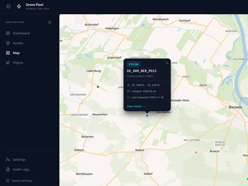
Access your data. Act on insights.
All collected data and AI-generated insights are delivered through
Beagle’s secure, Germany-hosted web platform – providing a
centralized, always up-to-date view of your infrastructure and
operations.
The platform enables your teams to access, analyze and act on
relevant information without the need for complex tooling or manual
data handling.
Key capabilities include:
- interactive map-based visualization of all collected data
- access to high-resolution imagery and historical datasets
- AI-generated detections and prioritized findings
The platform supports:
- integration into existing GIS and monitoring systems via APIs
- role-based access control for different stakeholders
- secure data sharing across teams and external partners
About us
Asset Intelligence for critical infrastructure – Built on data, not assumptions.
Europe’s energy and infrastructure networks are under pressure – from tightening regulation, aging assets, and the rising cost of legacy inspection methods.
Beagle Systems was built to change how operators see, understand, and protect their infrastructure.
We develop advanced remote sensing and analytics solutions that replace subjective, manual inspections with objective, structured, decision-ready data – delivered across thousands of kilometres of pipeline, construction corridor, and critical infrastructure, without a single person needing to set foot on-site.
Our certified BVLOS drone operations meet EU and national regulatory standards – including the EU Methane Regulation and critical infrastructure protection requirements (CER Directives) – so our customers gain compliance and insight simultaneously.
Our mission:
Turn the physical world into clear, actionable intelligence – enabling faster, safer, and more sustainable decisions for the operators.
“We believe in the system because it’s simply better, more consistent, provides better documentation and is good for the environment. What we particularly like is the combination of drone data and satellite data, because in between individual drone flights, you are operating without visibility.”
– Olaf Boenigk, Distribution Networks Operations
Resources
Case Study:
Hanse Gas replaced helicopter-based visual inspections of 1,400 km of high-pressure pipelines with monthly drone and satellite data captured by Beagle technology. AI analyzes the collected data for hazards. Read more

EU Approval:
Beagle is authorised to internally approve and conduct BVLOS (Beyond Visual Line of Sight) flights without personnel on site in accordance with EU Regulations 2019/945 and 2019/947.
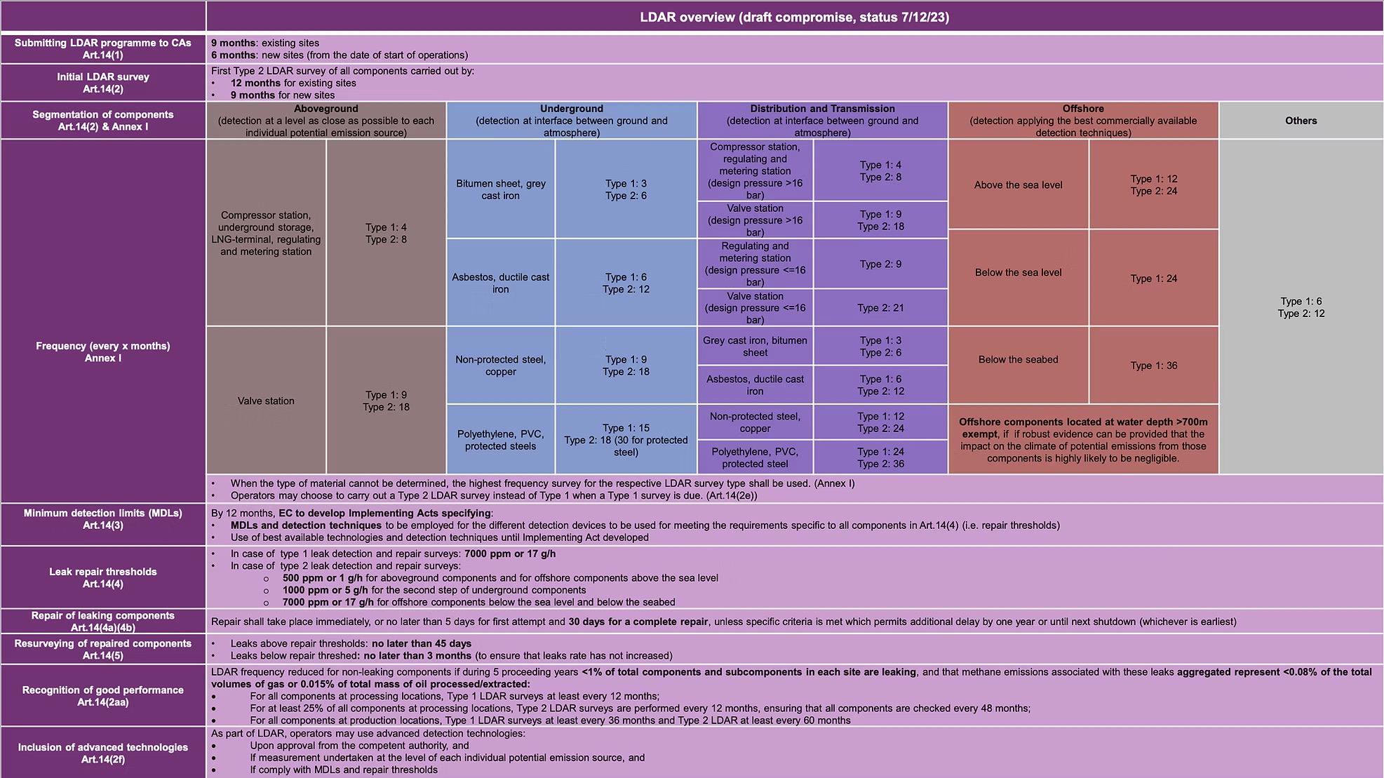
LDAR Overview:
We offer methane leak detection as a service, compliant with the EU methane regulation’s requirements for Type 1 and Type 2 LDAR surveys (17g/h and 5g/h). Read more